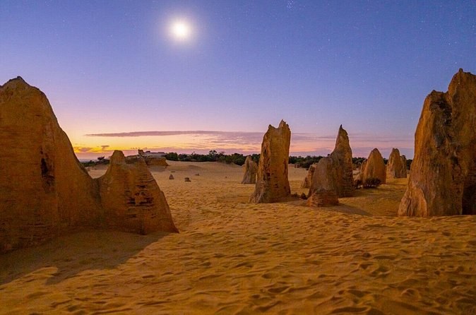
Pinnacles Desert Sunset Stargazing Adventure Tour from Perth
Park fees includedDinner includedTelescope provided
From $127 per person
The limestone here started as shell debris from marine organisms, ground down on the coast and blown inland by wind. Nothing about the Pinnacles is volcanic and nothing was pushed up from below. The material arrived one grain at a time, on the breeze.
The pillars formed buried, inside a body of sand, and stayed there. What produced the landscape is the last step in the sequence: prevailing wind stripped the covering quartz sand away and exposed them. Nobody uncovered the Pinnacles. The weather did.
Look at the top of almost any pillar and there is a distinctly different crown on it. That is calcrete, formed when leaching water redeposited calcium carbonate as a hard layer over the softer limestone. Where the lid held, a pillar survived. Where it failed, the stone went. The full sequence is on its own page.
Channels formed in that calcrete and roots exploited them. Water followed the roots down, dissolved the limestone beneath, and the channels filled with quartz sand. The gaps between the pillars are not where nothing was — they are where roots let the water in.
Rhizoliths — fossilised root casts — lie in the sand between the columns. They are the process caught halfway, and you will walk straight past them, because everybody is looking up. Look down once and you will find them.
The park authority describes thousands of limestone pillars up to 4 metres. Most are considerably shorter. They look larger than that because nothing else in the plain is more than knee high — you are the only thing there to measure them against, which is why every good photograph of the field has a person in it.
“Thousands” is as precise as the official description gets, and no authority publishes a number. Sand still moves across the field, so pillars are still being uncovered and reburied. Whatever you count on the day you visit is only true that day.
The first known European record of this coast dates to 1658, when the North and South Hummocks appeared on Dutch maps. One account holds that the Pinnacles were taken for a small city a short distance inland — and that the mariners could not go and look, because of the reefs.
Nambung National Park takes its name from the Nambung River, and the spelling was adopted in 1938. The name derives from an Aboriginal word possibly meaning crooked or winding. You will not see the river on a day visit: it runs into an underground karst system and seeps out along the coast.
The Nambung area was frequented by the Whadjuk and Yued people of the Noongar cultural group. The park is a recent administrative layer over a much older relationship with the same ground.
The field remained relatively unknown to non-Aboriginal Western Australia until the late 1960s. A reserve was gazetted in 1967 specifically for the “preservation of natural formations — Pinnacles”, and the three reserves became one national park in July 1994.
Nambung National Park covers 18,362 hectares. The desert area you drive through is a fraction of that, and the rest is heath, coast and dunes — including Hangover Bay and Kangaroo Point, which are swimming beaches inside the same boundary.
Nambung National Park holds significant limestone cave systems, and fewer than a hundred karst features are recorded across the park and its neighbouring reserves — subterranean drainage, sinkholes, residual cone hills, limestone pillars and root concretions. The pillars you photograph are one expression of a much larger system.
The park and its neighbouring reserves record at least eight native mammal, 103 bird, seventeen reptile and three frog species. Carnaby’s black-cockatoo is gazetted as rare or likely to become extinct; the carpet python and the peregrine falcon are declared in need of special protection. The area is also the stronghold of a disjunct coastal population of the white-breasted robin.
Lake Thetis, four kilometres outside Cervantes, holds living microbial reefs dated at about 3,370 years. Very few places in the world have living marine stromatolites, and one of them is on the road you drive to get here.
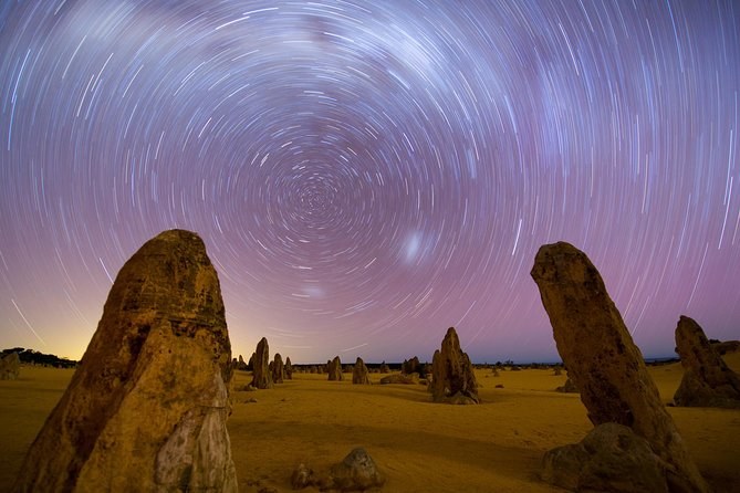
Full astronomical dark arrives at 6:51 pm in June and 9:00 pm in January, and visitors are expected out of the park by 9 pm. That means winter gives you two hours of genuinely dark sky here and midsummer gives you almost none — which is the opposite of what most people assume. The month-by-month page has all twelve.
| Fact | Figure | Where it comes from |
|---|---|---|
| Tallest pillars | up to 4 metres | WA park authority |
| Limestone unit | Tamala Limestone | Management plan |
| When the limestone was laid down | 1,500,000 to 10,000 years ago | Management plan |
| Park area | 18,362 hectares | Management plan |
| Pinnacles reserve gazetted | 1967 | Reserve 28393 |
| National park created | July 1994 | Management plan |
| Lake Thetis reefs | about 3,370 years old | Trails WA |
| Earliest full dark | 6:51 pm, June | Computed for the site |
| Latest full dark | 9:00 pm, January | Computed for the site |
Almost all of it is in one document: the Western Australian park authority’s own management plan for Nambung National Park, which sets out the geology, the naming, the tenure history and the species lists. The rest is the department’s current site pages and computed solar times. The facts page collects every figure with its source, and Pinnacles Tours lists the departures with a guide who can explain them on the ground.
From $127 per person
From $145 per person